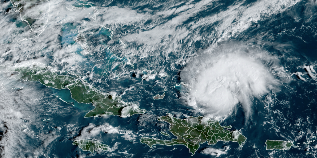
The latest advisory from the National Hurricane Center said Tropical Storm Nadine nears landfall in Belize, while Invest 94L organizes north of Haiti and the Dominican Republic with a 60% chance of development in 48 hours. Oct. 19, 2024.
As of 11:00 A.M. on Saturday, Invest 94L strengthened into Tropical Storm Oscar. Continuous coverage of Tropical Storm Oscar has moved here.
MIAMI — A tropical disturbance that has spent days in the Atlantic Ocean struggling to get organized erupted to life Saturday, and is now likely just hours away from developing into a tropical depression, or even a tropical storm.
The storm, currently designated Invest 94L, suddenly developed a well-defined center Saturday morning, and continues to produce a concentrated area of showers and thunderstorms as it sits located less than 100 miles east of the Turks and Caicos Islands, according to the National Hurricane Center.
Just 75 minutes after the NHC raised the odds of development from 30 to 60%, the agency put out a special statement now indicating advisories on a tropical depression or tropical storm will likely be issued later Saturday morning.
“Winds on the north side of the system appear to be just under tropical storm strength of 40 mph,” says FOX Weather Hurricane Specialist Bryan Norcross. “But if it fully organizes, it won’t take much to become Tropical Storm Oscar.”
If Oscar is declared, it would become the second tropical storm to get a name on Saturday, joining Tropical Storm Nadine, which was christened early Saturday morning near Belize.
TROPICAL STORM NADINE THREATENING TORRENTIAL RAINS IN BELIZE, SOUTHERN MEXICO
The NHC is advising interests in the Turks and Caicos Islands, the southeastern Bahamas, and eastern Cuba should closely monitor this system as tropical storm warnings could be required later Saturday morning. The NHC is now giving a 90% chance of becoming a tropical cyclone.

(FOX Weather)
Invest 94L is expected to pass north of Hispanola Saturday and then move near the Turks and Caicos Islands, the southeastern Bahamas, and extreme eastern Cuba on Sunday, the NHC said. The storm could bring heavy rains, rough surf and gusty winds.
“It is forecast to linger there (near eastern Cuba) into Monday, likely as a weak system,” Norcross said. “Hostile upper winds will move in and whatever’s left of it will likely be swept to the north. As the system meanders, it could bring heavy rain to the southeastern Bahamas, Haiti, and eastern Cuba before it dissipates or is scooped to the north. It should be out of the picture early next week.”
Could Invest 94L reach the US?

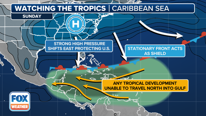
While the northern Caribbean islands should monitor 94L’s progress, the storm remains no threat to the US.
An expansive ridge of high pressure anchored over the East Coast is acting like a protective barrier, with a front at the ridge’s boundary providing hostile atmospheric conditions for any tropical systems to approach Florida or the Southeastern coast.

